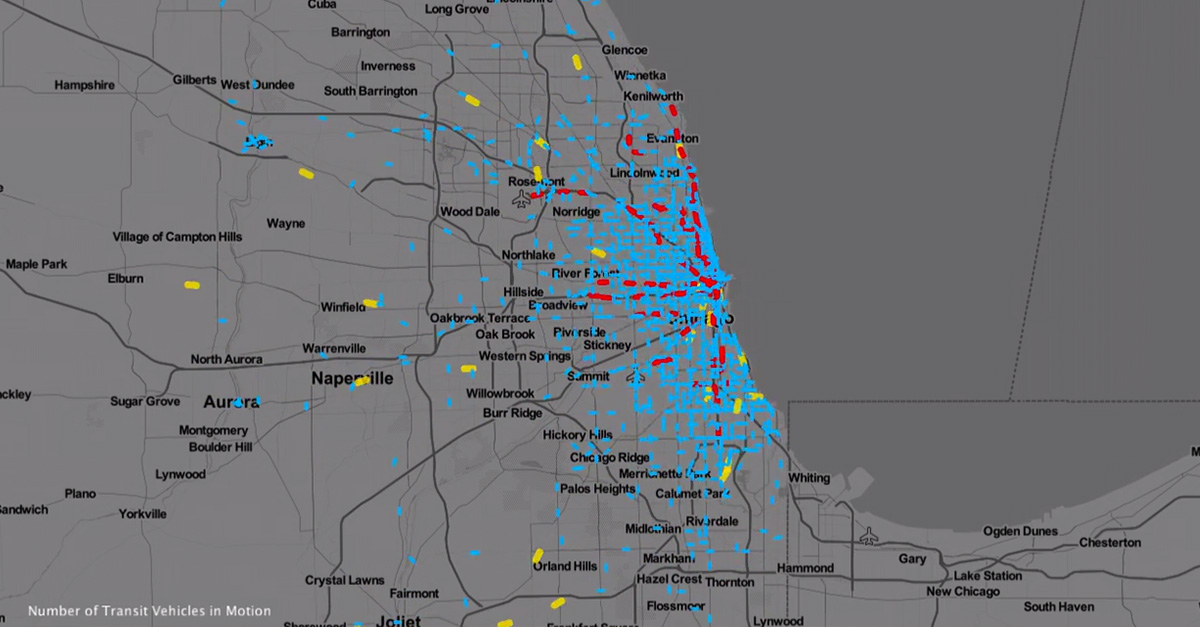
No one likes sitting in traffic, and planning a commute in and around the city can be additionally confusing. A new time-lapse video shows the Chicago transit patterns throughout the day, which illuminates patterns and trends in the city and the surrounding areas.
Videos by Rare
For instance, the quietest hours for transportation is around 3 a.m., while the heaviest hour is between 5-6 p.m.
The map is a part of a collection of visualizations called “TransitFlow” by Will Geary made with Mapzen, technology that aggregates transportation data.
Geary hopes that the visualizations can provide insight beyond simply being a cool thing to look at.
“I think this tool is good for making comparisons visually. Whether it’s comparing different days or different cities, or existing and proposed transit infrastructure projects,” Geary told City Lab. “It has the potential to improve communication between engineers, cities and the interested public to talk about future and proposed transit scenarios.“
He’s created them for other cities, including San Francisco, Mexico City, New York City and Prague.