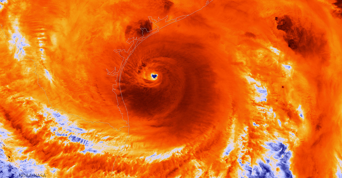
Harvey is expected to gain back some strength after it moves into the Gulf over the next few days, and it could take that force with it into Louisiana.
Videos by Rare
Parts of Louisiana could see rain up to 25 inches as Harvey moves east https://t.co/B4ONV8GuUO
— NOLA.com (@NOLAnews) August 28, 2017
Now rated as a tropical depression, Harvey is still causing serious flooding across southeast Texas, with thousands of people having to leave their homes and rescue efforts still ongoing. NOLA.com claims that the city of New Orleans could see flooding at a rate of two inches per hour. Storm swells similar to the ones that caused so much damage in Texas are also predicted.
RELATED: How Are Houston’s Homeless Men and Women Weathering Harvey?
Harvey’s path has taken it on a weird, meandering route, moving back southward on Sunday. It will likely remain in the area of the Gulf for a couple of days before moving northeast through the middle of the week, according to weather reports.
The national weather service, as of Monday, has issued flash flood warnings for parts of Louisiana. Lafayette, New Iberia and Abbeville are under flash flood warnings until 2:30 this afternoon, and Ville Platte, Opelousas and the surrounding area are under warning until 3:30 p.m. New Orleans is expected to get some rain Monday night as well, but wasn’t under flood warning as of 9:30 a.m.
RELATED: Drone Footage From Pearland Shows the Impact of Harvey.