Autumn is almost here and I can’t wait for the breeze and the cold air to take over ASAP. Time to unpack all those sweaters that have collected dust throughout the year and start making those yummy homemade recipes that include pumpkin, sugar maple, and pretty much all the cinnamon you can find in your pantry. No matter how you decide on to celebrate that fall is almost here, whether it’s by picking apples or decorating with your favorite fall-themed items, nothing is more festive than looking outside your window and seeing those leaves slowly falling down seeing those beautiful fall colors.
Videos by Rare
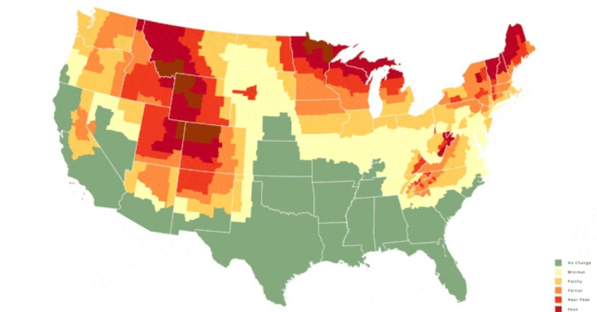
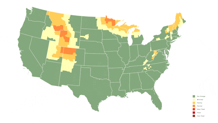
Which is why I’m here to introduce you to this wonderful interactive map that tells you exactly when autumn leaves are expected to change in your area this time of year. Yes, of course, we can always keep an eye on the temperature, but I feel like this is more fun just because it makes it more interesting. The popular tourist website, Smoky Mountains, decided to put up its annual map to help you determine which spots in the country are the best places to travel and see the peak colors change right before your eyes. Every year the site updates an interactive map that shows each region as it begins to experience fall. According to the map, leave begin to hit their peak color in late September and early October.
According to David Angotti, founder and statistical expert of the company, “The map should be especially useful to potential travelers, leaf-peepers, and photographers as they pick future dates for trips to view peak fall and the highest elevations in each area of the United States.”The date picker, which can be easily found at the bottom of the map, visualizes forward progress for both in their specific destination and the entire country. For example, September 7th on the slider will display when Fall Foliage is expected for the week of September 7th to 13th. The database interactive tools will increase the number of people that are able to enjoy fall in 2020.
The Fall Foilage prediction map, which is on smokymountains.com was created by analyzing several data points, according to creators, and was put together county-by-county utilizing everything from Weather forecast, Atmospheric Administration, and National Oceanic precipitation forecast to the average daylight exposure and temperature forecast.
The map will help you schedule your autumn getaway whether you are planning to see gold in Colorado or sugar maple leaves turn red in Tennessee. According to the prediction, by September 21st, parts of Wyoming, Colorado, Utah, Montana, Minnesota, Michigan, Wisconsin, New Hampshire, Vermont, and Mail will be near or already have peaked at fall foliage. So yeah, timing is everything.
That being said, while no weather prediction tool is 100 percent accurate, their past interactive fall color maps have been pretty accurate. A recommendation before you decide to go on a road trip to see the beautiful colors, make sure you research beforehand to see what your best chance of seeing those loose leaves fall, based on where you live. The last thing you want is to see more green than red or orange. Or worse, be greeted by a forest that is basically brown. So here’s to the wonderful fall season and to the peak Fall Foliage across the US. What’s your favorite Fall color? Mine is Red Maple!