These before and after photos of Hurricane Katrina’s mammoth trail of damage will leave you breathless
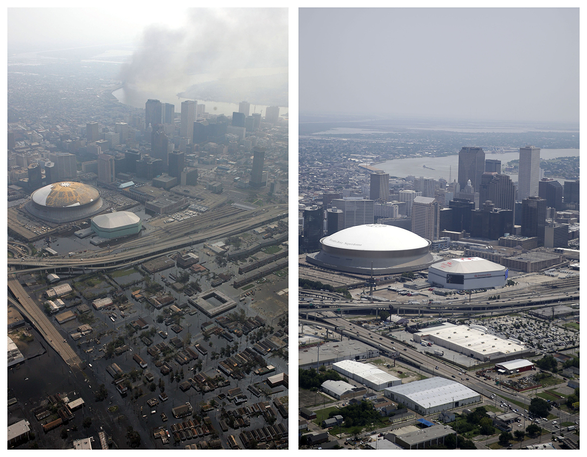
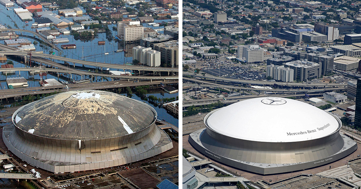
This combination of Aug. 30, 2005 and July 29, 2015 aerial photos shows downtown New Orleans and the Superdome flooded by Hurricane Katrina and the same area a decade later. Katrina's powerful winds and driving rain bore down on Louisiana on Aug. 29, 2005. The storm caused major damage to the Gulf Coast from Texas to central Florida while powering a storm surge that breached the system of levees that were built to protect New Orleans from flooding. (AP Photo/David J. Phillip, Gerald Herbert)
When Hurricane Katrina ripped through the Gulf Coast nearly 10 years ago on Aug. 29, 2005, it left a mammoth trail of damage in its wake.
Videos by Rare
Storm surge and winds ripped the top off a church steeple in Mississippi, left a tangle of fishing boats sitting in the middle of a Louisiana highway and ripped holes into the New Orleans Superdome’s roof.
Flooding caused by breached levees in New Orleans stranded tens of thousands of people in horrific conditions at the football stadium and convention center, flooded houses in Lakeview to the eaves and left a parking lot full of waterlogged school buses.
This is a collection of photos by Associated Press photographers of many of those locations showing how they looked in the days after the storm and how they look now.
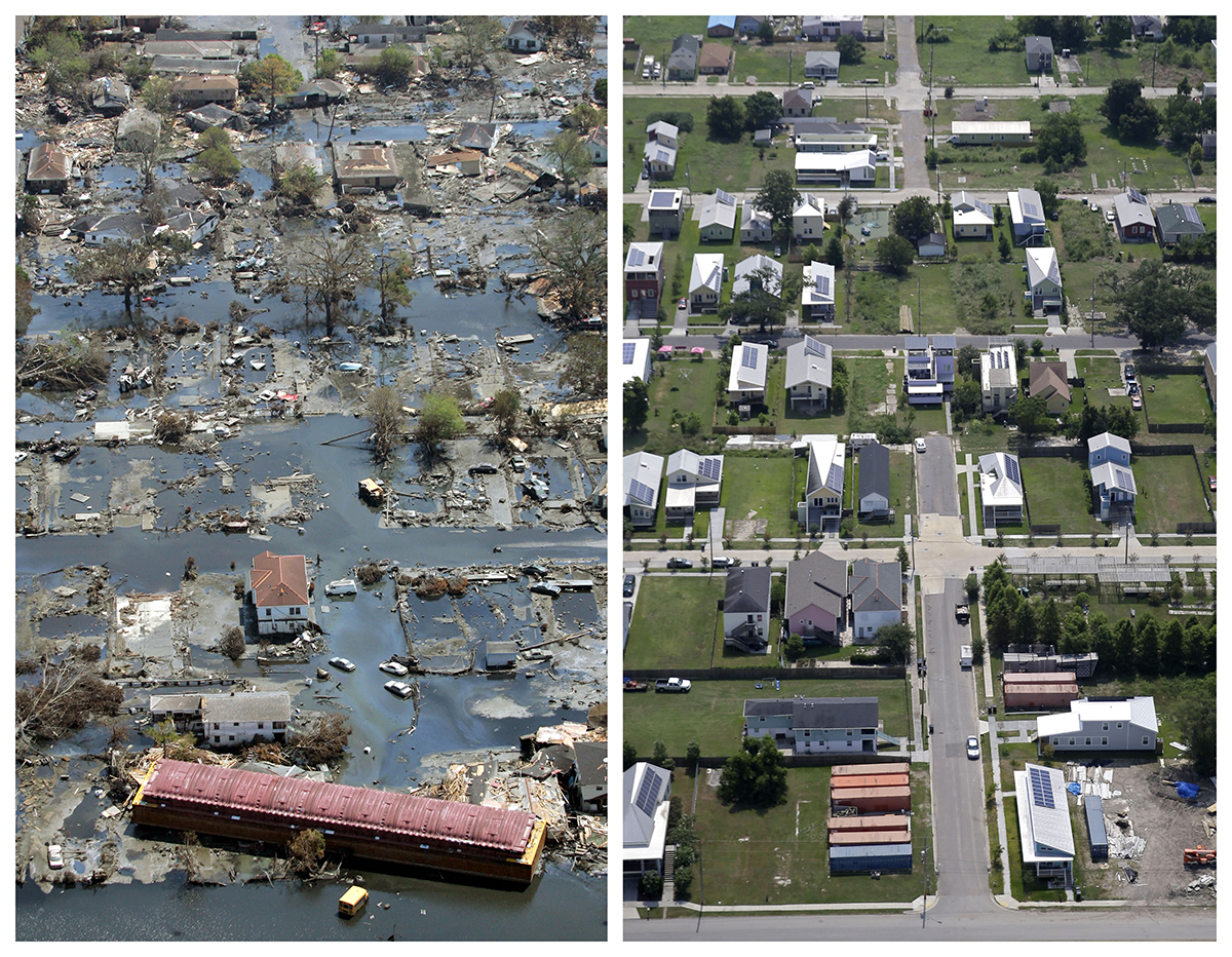
This combination of Sept. 11, 2005, and July 29, 2015, aerial photos show the Lower Ninth Ward of New Orleans. Before Katrina, the area was a working-class and predominantly African-American neighborhood just outside the city’s historic center. (David J. Phillip, Gerald Herbert / Associated Press)
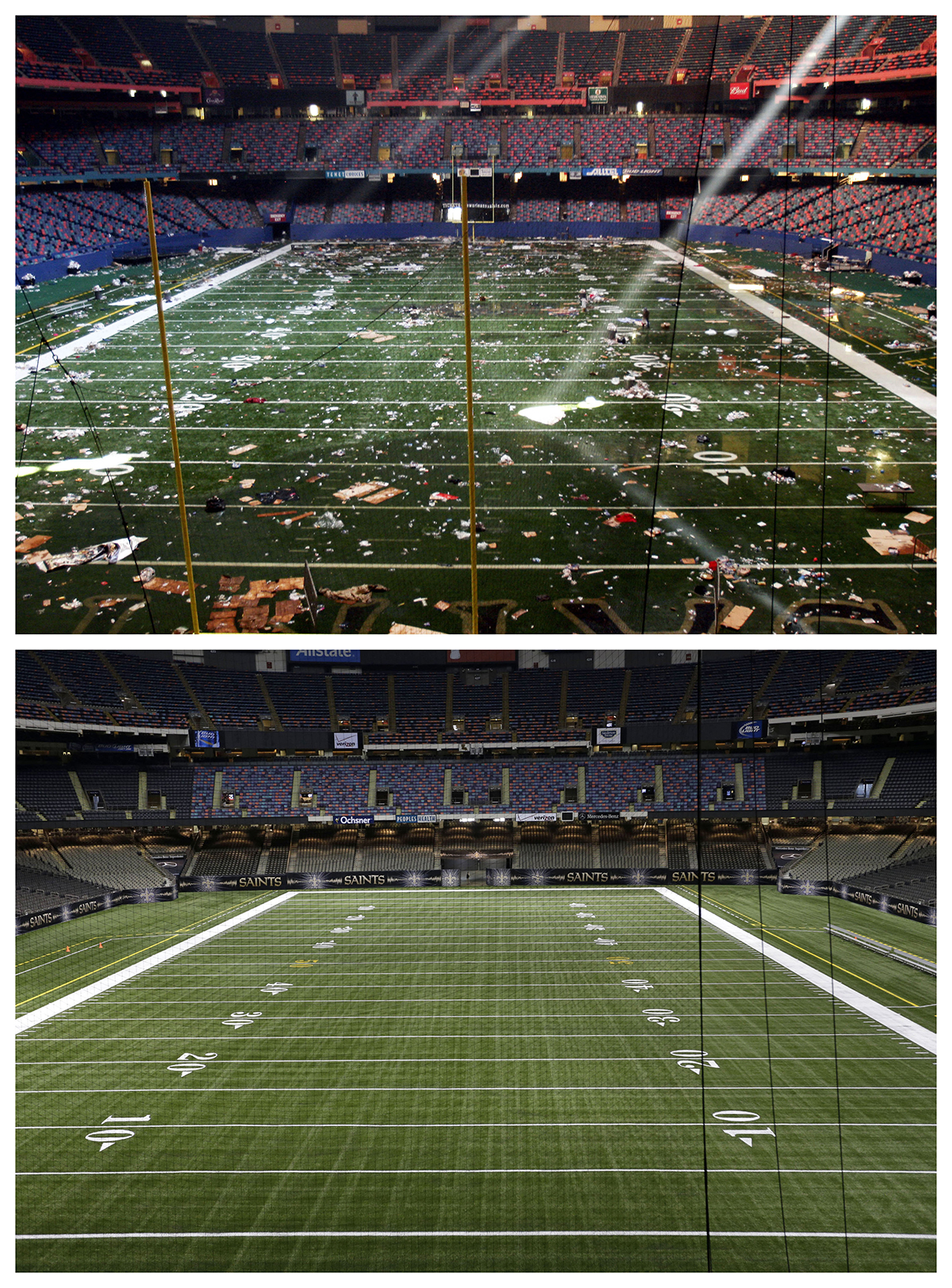
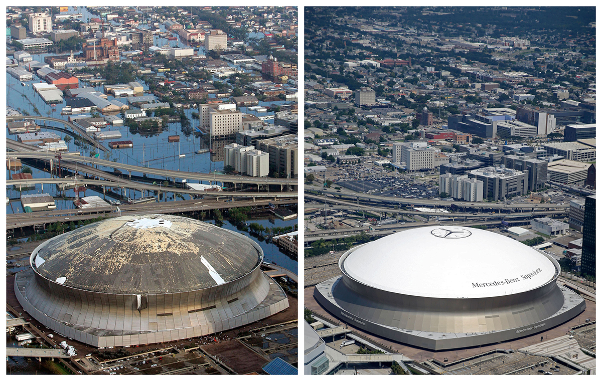
This combination of Sept. 2, 2005, and Aug. 14, 2015, photos shows the playing field of the Louisiana Superdome in New Orleans littered with debris after serving as a shelter for victims from Hurricane Katrina, and a decade later, the renamed Mercedes-Benz Superdome. (Bill Haber, Gerald Herbert / Associated Press)
This combination of Aug. 30, 2005, and July 29, 2015, aerial photos show the Mid City and Palmetto areas of New Orleans. The storm went down in history as the costliest natural disaster to strike the U.S., with $150 billion in damages to homes and other property. (David J. Phillip, Gerald Herbert / Associated Press)
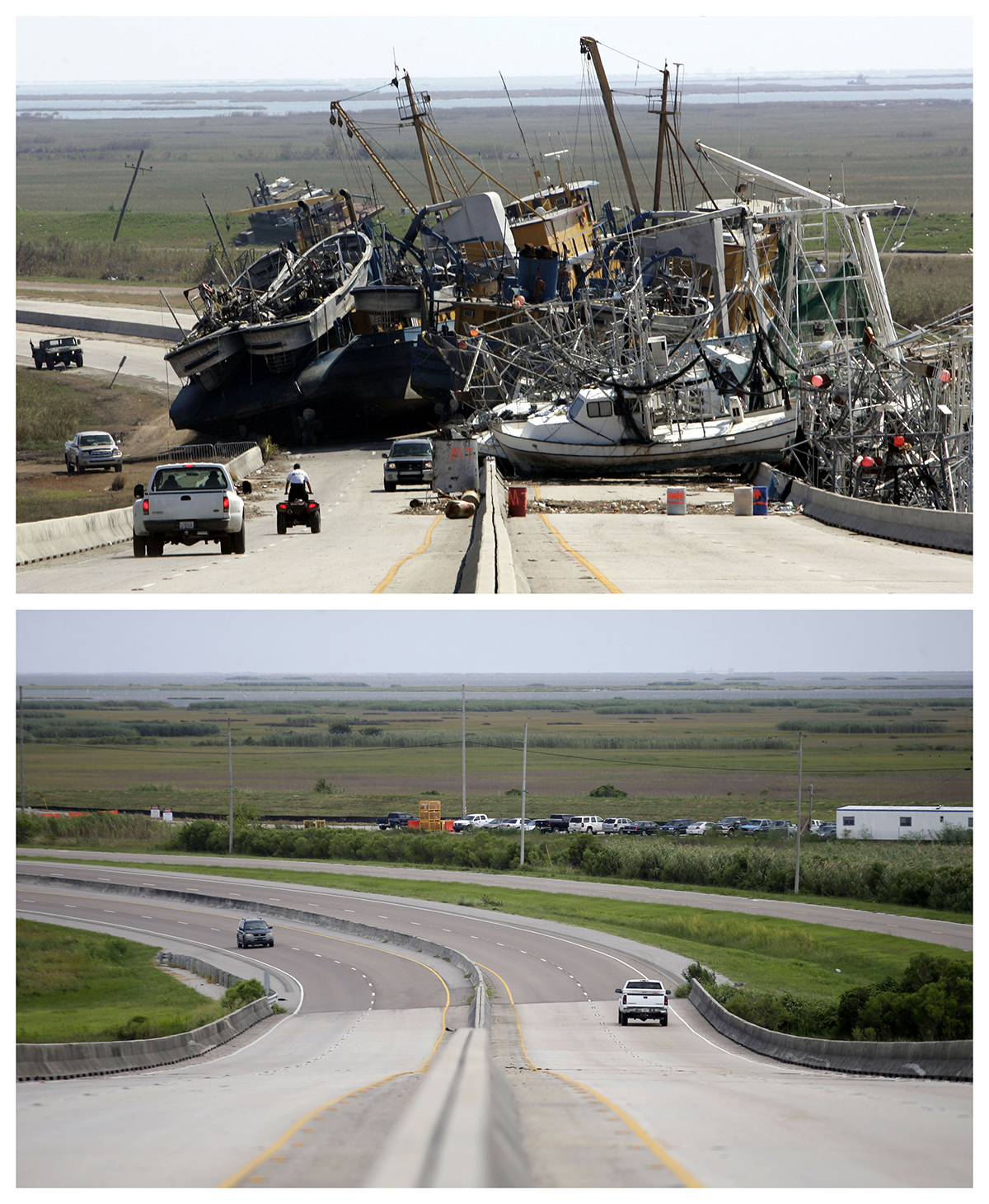
This combination of Oct. 10, 2005, and Aug. 4, 2015, photos shows a tangle of fishing boats blocking the lanes of Highway 23 in Empire, Louisiana, after Hurricane Katrina ravaged the region, and the same site a decade later. (Don Ryan, Gerald Herbert / Associated Press)
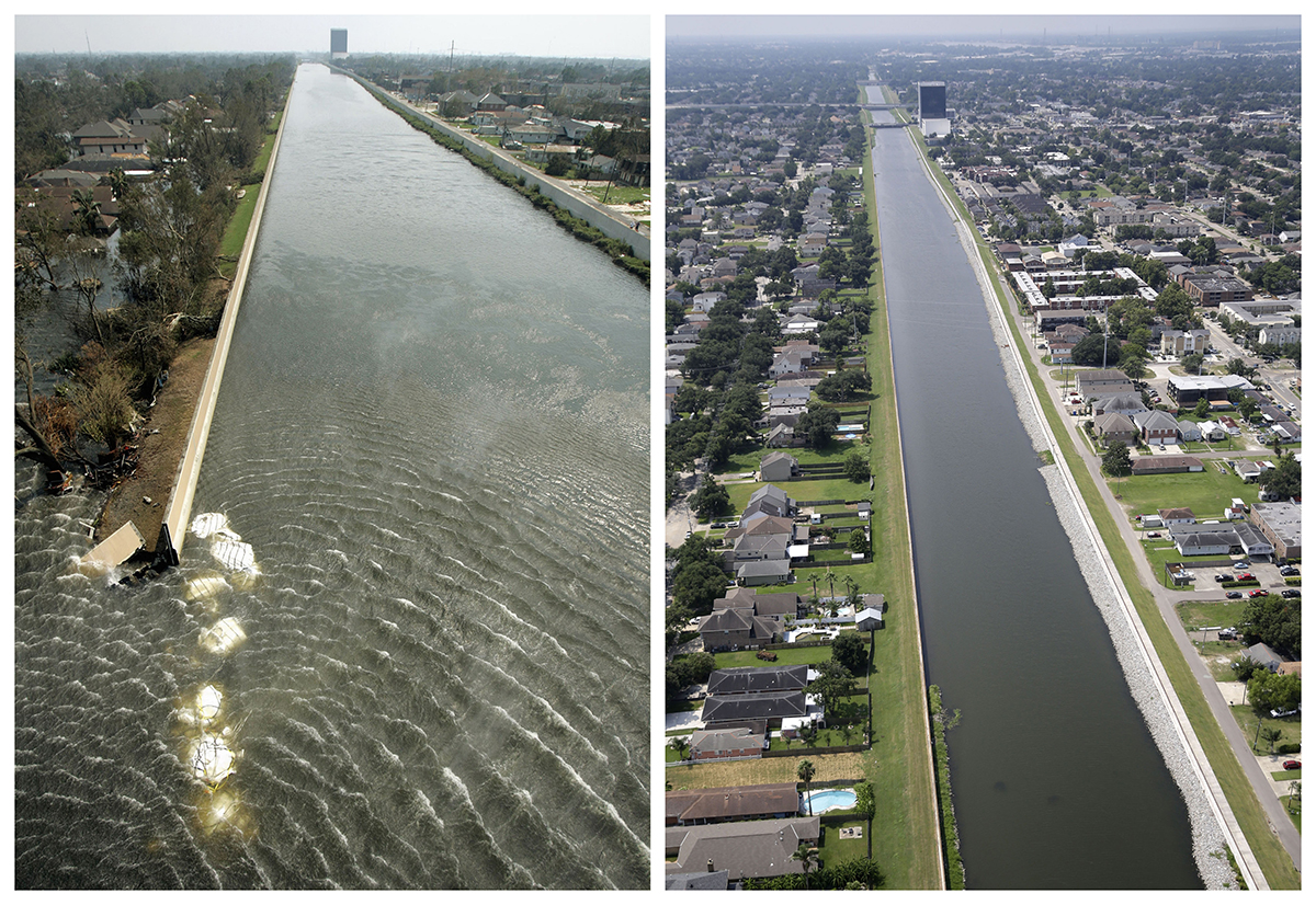
This combination of Sept. 3, 2005, and July 29, 2015, aerial photos show the 17th Street Canal flood wall breach and the Lakeview section of New Orleans. Katrina’s powerful winds and driving rain bore down on Louisiana on Aug. 29, 2005. (Haraz N. Ghanbari, Gerald Herbert / Associated Press)
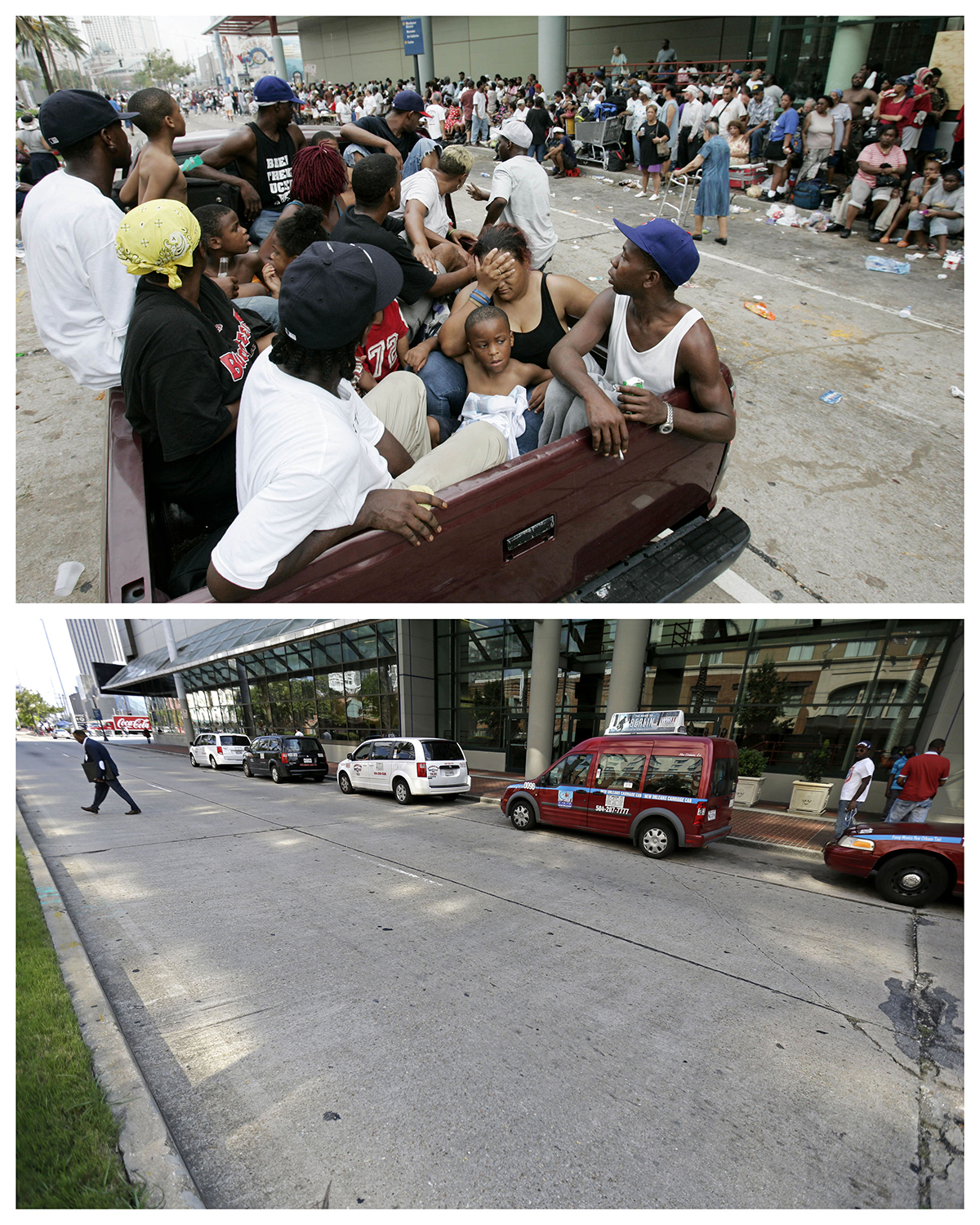
This combination of Sept. 1, 2005, and Aug. 14, 2015, photos shows flood victims in a pickup truck as hundreds of others wait for evacuation at the Ernest N. Morial Convention Center in New Orleans in the aftermath of Hurricane Katrina, and the same site a decade later. (Eric Gay, Gerald Herbert / Associated Press)
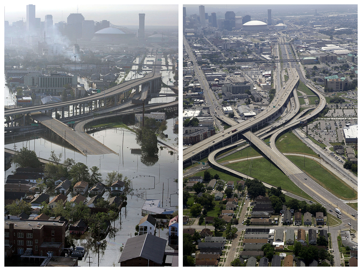
This combination of Aug. 30, 2005, and July 29, 2015, aerial photos shows downtown New Orleans and the Superdome. The storm caused major damage to the Gulf Coast from Texas to central Florida while powering a storm surge that breached the system of levees that were built to protect New Orleans from flooding. (David J. Phillip, Gerald Herbert / Associated Press)
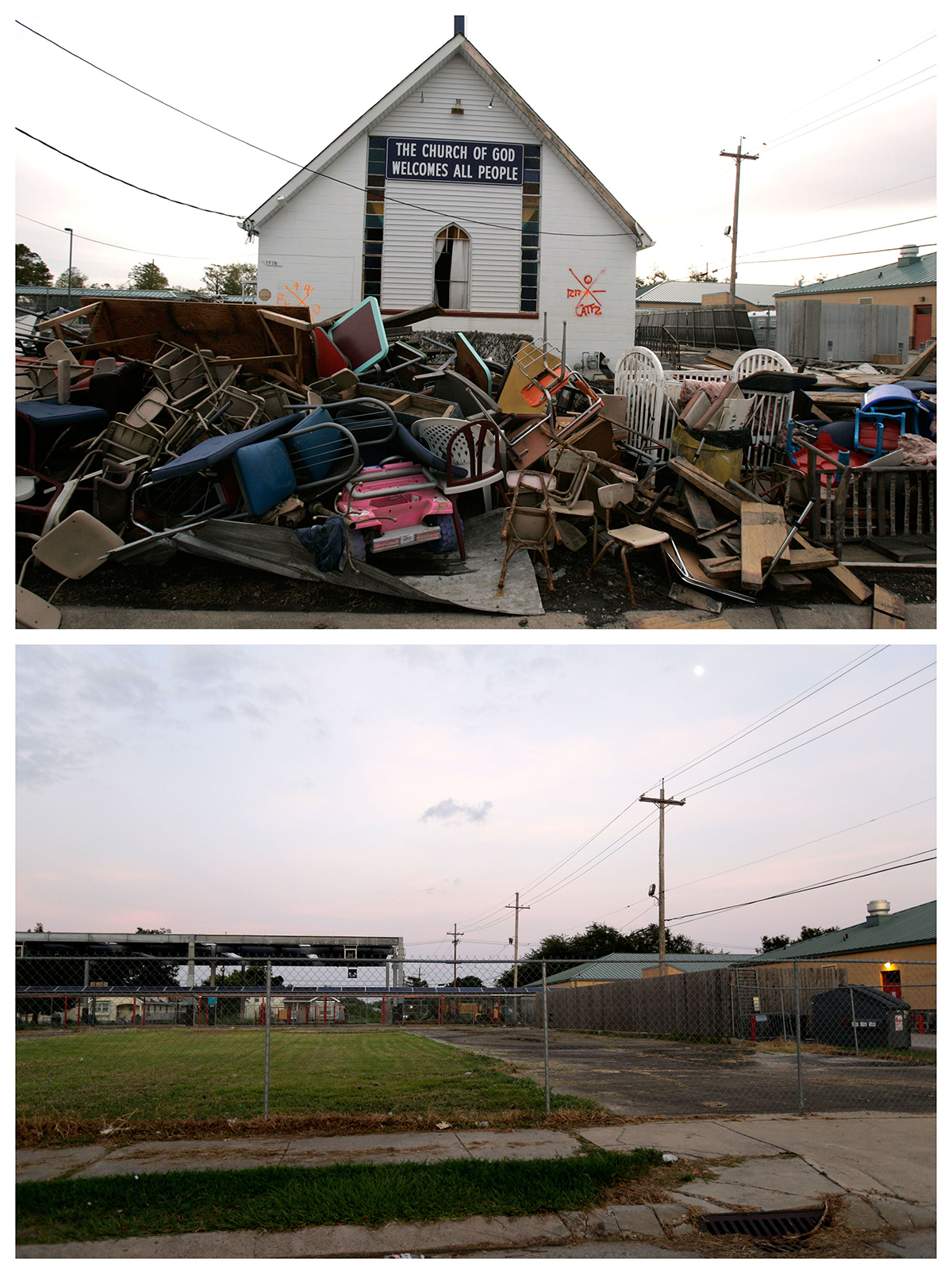
This combination of Dec. 16, 2005, and July 28, 2015, photos shows debris in front of the Church of God damaged by Hurricane Katrina in the Lower Ninth Ward neighborhood of New Orleans, and a decade later, an empty lot where it once stood. (Jacqueline Larma, Gerald Herbert / Associated Press)
This combination of Sept. 3, 2005, and July 29, 2015, aerial photos show downtown New Orleans flooded by Hurricane Katrina, and the same area a decade later. The storm was one of the deadliest in U.S. history — nearly 2,000 people died. (David J. Phillip, Gerald Herbert / Associated Press)
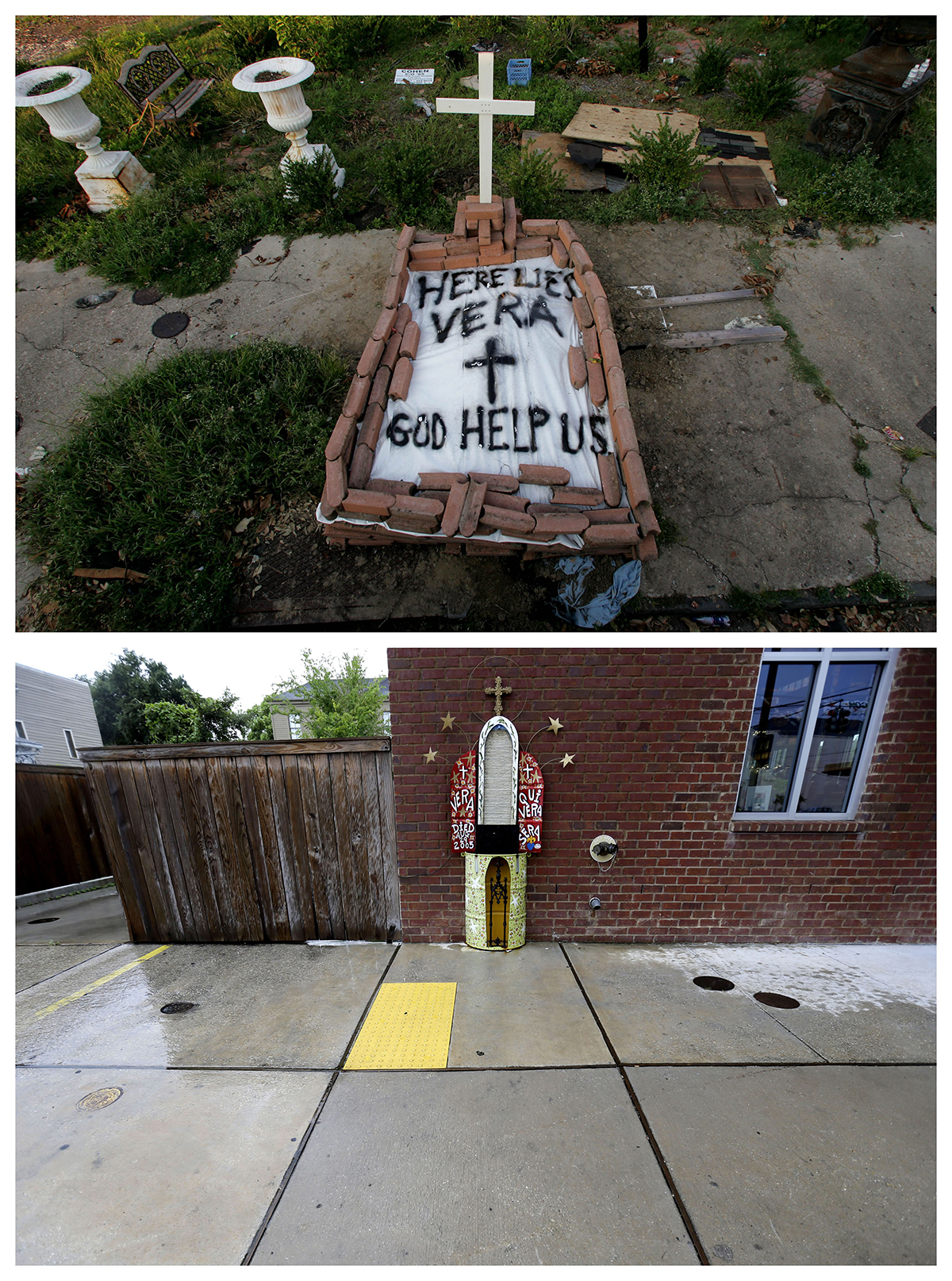
This combination of Sept. 4, 2005, and July 30, 2015, photos show a makeshift tomb at a New Orleans street corner, concealing a body that had been lying on the sidewalk for days in the wake of Hurricane Katrina, and the same site a decade later with an artist’s memorial to the woman known as Vera. Nearly 2,000 people died because of the storm, mostly in New Orleans, 80 percent of which was flooded for weeks. One million people were displaced. (Dave Martin, Gerald Herbert / Associated Press)
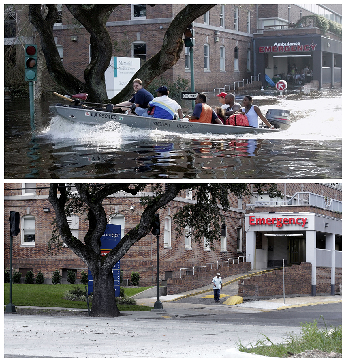
In this combination of Wednesday, Aug. 31, 2005, and Thursday, July 30, 2015, photos, patients and staff of the Memorial Medical Center in New Orleans are evacuated by boat after flood waters surrounded the facility, and a decade later, the renamed Ochsner Baptist Hospital. (Bill Haber, Gerald Herbert / Associated Press)
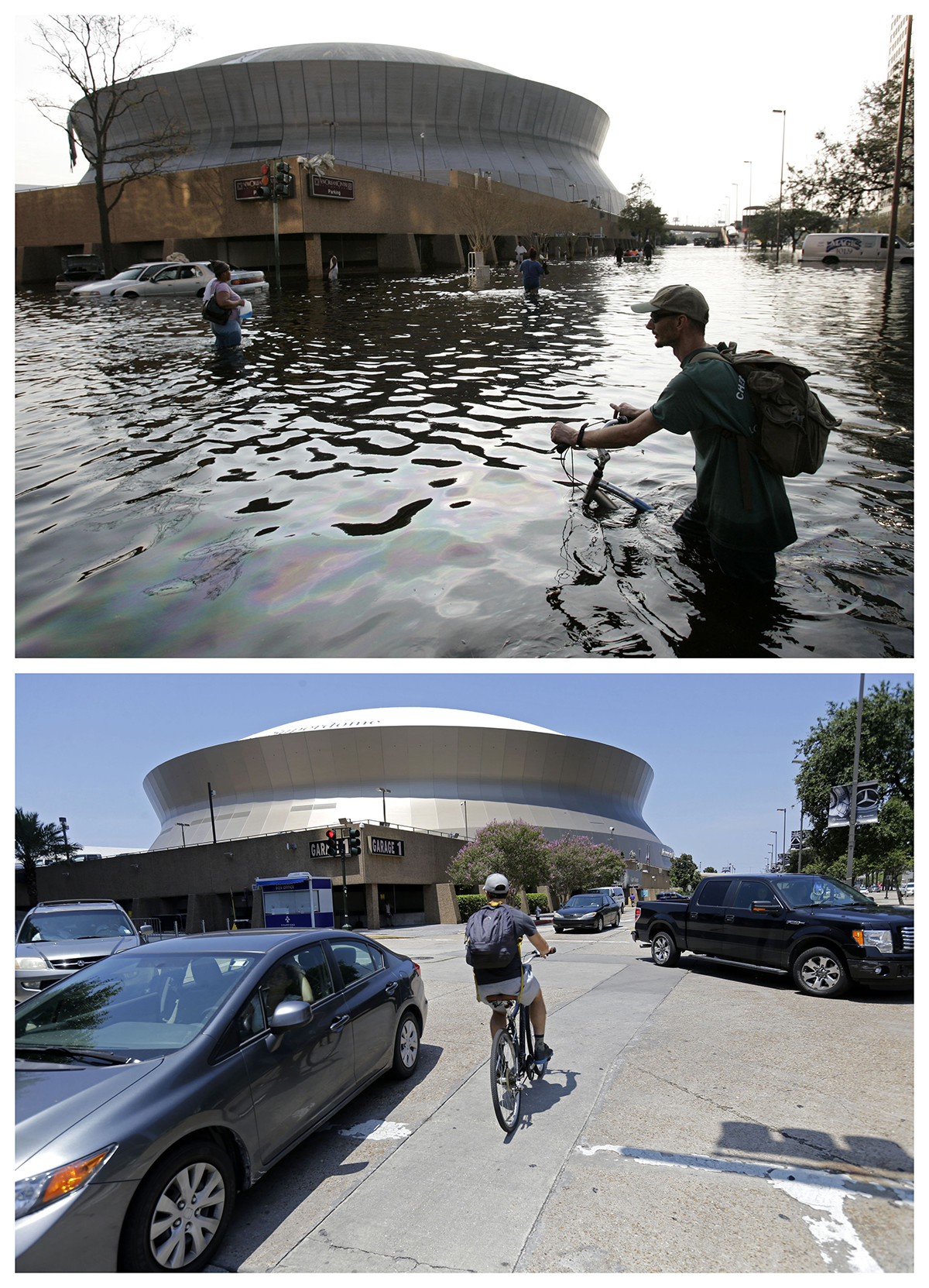
This combination of Aug, 31, 2005, and July 31, 2015, photos shows a man pushing his bicycle through flood waters near the Superdome in New Orleans after Hurricane Katrina left much of the city under water, and a cyclist outside the renamed Mercedes-Benz Superdome a decade later. (Eric Gay, Gerald Herbert / Associated Press)